


ข้อมูล
| เอกสารสิทธิ | ขนาด |
| 0 ไร่ - 0 งาน - 0 ตรว |
สิ่งอำนวยความสะดวก
อสังหาล่าสุด
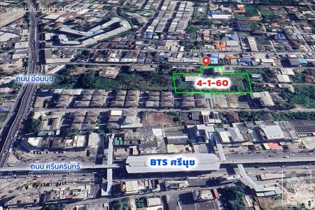
ที่ดินพร้อมสิ่งปลูกสร้าง แขวงสวนหลวง เขตสวนหลวง
280,000,000 บาท
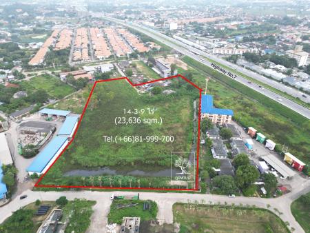
ที่ดิน ต.หนองปรือ อ.บางละมุง
140,000,000 บาท

คอนโด ต.คลองตำหรุ อ.เมืองชลบุรี
850,000 บาท
โฆษณา

| เอกสารสิทธิ | ขนาด |
| 0 ไร่ - 0 งาน - 0 ตรว |
280,000,000 บาท
140,000,000 บาท
850,000 บาท